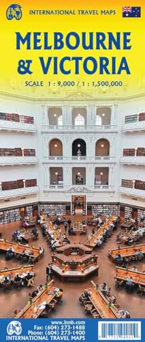
Introduction to Melbourne Maps
Melbourne, Australia, stands as a vibrant metropolis recognized for its rich cultural scene, diverse neighborhoods, and extensive transport networks. Navigating this lively city can be a rewarding experience, yet it can also present challenges, especially for newcomers. Therefore, access to various types of maps becomes indispensable for both tourists and local residents alike. Maps serve not only as navigational tools but also as resources that enhance our understanding of the city’s layout, attractions, and hidden gems.

When traversing Melbourne, it is imperative to consider the multitude of activities and destinations that the city has to offer. From its renowned laneways, bustling markets, and public parks to significant landmarks such as the Royal Botanic Gardens and Melbourne Zoo, each locality presents its own unique set of features that can be better appreciated with the help of well-designed maps. Furthermore, the urban landscape is ever-changing, making updated maps necessary for effective exploration.
Transportation within Melbourne can be complex due to the extent of its public transport system, which includes trams, trains, and buses. Accurate maps are crucial in aiding users to locate tram routes, train stations, and bus stops, thereby helping to streamline their travel experience. Additionally, information regarding bike lanes and walking paths can also be found on specific maps, catering to eco-conscious explorers who wish to experience the city more intimately.
In essence, whether one is a tourist yearning to explore iconic sites or a local seeking to discover new neighborhoods, the utility of maps cannot be overstated. They not only guide but also inspire curiosity, facilitating a deeper connection with Melbourne’s diverse community and dynamic urban experience.
Types of Maps Available for Melbourne
Melbourne, Australia, is a vibrant city with a rich array of maps that cater to various interests and needs. Understanding the types of maps available can significantly enhance both the tourist experience and everyday navigation for residents. The primary categories include tourist maps, transportation maps, street maps, and thematic maps, each serving a distinct purpose.
Tourist maps are specifically designed to highlight attractions, shopping districts, dining options, and cultural landmarks. These maps often include essential information like public toilets and open hours, making them invaluable for newcomers and tourists. They can guide visitors through the city’s major attractions like Federation Square, the Royal Botanic Gardens, and the Melbourne Zoo. Furthermore, many tourist maps also feature illustrations and photographs that enhance their visual appeal, providing both practical guidance and a sense of what to expect.
Transportation maps are another crucial resource, especially for those reliant on the city’s tram, train, and bus systems. These maps illustrate the extensive network of public transport routes, making it easier for both residents and visitors to navigate Melbourne’s public transit options. Understanding this map can help individuals plan their journeys effectively, ensuring they reach their destinations without unnecessary delays.
Street maps are essential tools for anyone wishing to explore the city on foot or by car. They provide detailed layouts of streets, helping users to familiarize themselves with the city’s geography. Street maps often include key landmarks, enabling users to identify their surroundings quickly and mark significant locations they wish to visit or transit through.
Lastly, thematic maps focus on particular aspects of Melbourne, such as its cultural or historical significance. These maps provide insights into the city’s heritage by highlighting important historical sites, galleries, and museums. They can enhance the experience of visitors seeking to understand Melbourne’s diverse cultural landscape. Familiarizing oneself with the different types of maps available for Melbourne can greatly enrich both the travel experience and day-to-day life in the city.
Where to Find Free Maps of Melbourne
Finding free maps in Melbourne is essential for locals and tourists alike who wish to navigate the city effortlessly. There are several reliable resources and locations where individuals can obtain these maps both in physical and digital formats.
One of the primary sources for free maps of Melbourne is local tourist information centers. These centers are strategically located throughout the city and provide visitors with detailed street maps, tourist guides, and brochures featuring various attractions. Key locations include the Melbourne Visitor Centre at Federation Square and the numerous branches of the City of Melbourne’s visitor services.
Additionally, public libraries around the city often offer complimentary maps. The State Library of Victoria, a significant educational hub, hosts a variety of maps covering Melbourne’s history and layout. Visitors can not only access printed maps but also utilize their digital resources for an interactive experience.
Online resources are equally abundant for those who prefer a digital approach. Websites such as the official Visit Melbourne site provide downloadable maps that highlight the best attractions, dining options, and entertainment venues across the city. Online platforms like Google Maps serve as a dynamic tool that can guide users in real-time as they explore various neighborhoods.
Public transport hubs, including train stations, tram stops, and bus terminals, also distribute free maps. Melbourne’s public transport system offers pamphlets that include maps outlining tram routes, train lines, and bus services, making it easier to traverse the city’s extensive transport network.
In summary, whether you prefer traditional printed maps or digital guides accessible through various online platforms, Melbourne boasts a myriad of options for obtaining free maps, ensuring that all explorers can navigate the vibrant city with ease.
Tips for Using Melbourne Maps Effectively
Melbourne is a vibrant city renowned for its diverse culture and intricate layout, which can be navigated effectively with the right approach to map usage. When utilizing maps of Melbourne, it is essential to familiarize yourself with various public transportation maps available. These maps highlight tram, train, and bus routes, enabling visitors and locals alike to navigate the city quickly and efficiently. Understanding how these transport networks interconnect will significantly enhance your travel experience.
It is also advisable to pay attention to the street layout provided in city maps. Melbourne’s streets are often arranged in a grid pattern, which simplifies navigation. Learning key landmarks and intersections can further aid in orienting oneself while traveling. When marking your points of interest on the map, consider categorizing them based on proximity to transport links or attractions.
In pairing physical maps with mobile applications, users can benefit from real-time navigation capabilities. Many applications offer features like live traffic updates, public transport schedules, and pedestrian paths, making them invaluable tools. However, relying solely on digital means can pose challenges, especially in areas with poor cellular reception. Therefore, having a physical map as a backup can prove invaluable during such times.
Moreover, while using digital maps, be cautious of battery life and try to download maps in advance. Many mapping applications allow users to download routes for offline use, which is particularly useful when exploring Melbourne without reliable internet access. By integrating both traditional and modern navigation tools, exploring Melbourne can be a seamless and enjoyable experience for everyone.